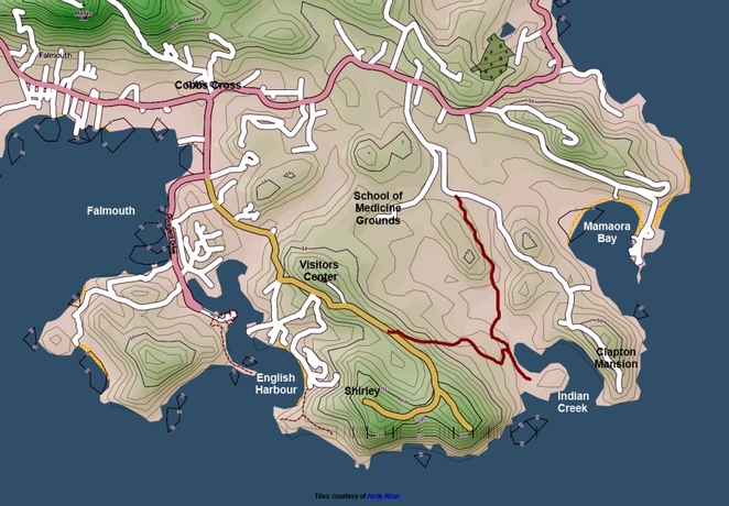
Shirley Heights To Indian Creek & Beyond
Level: Moderate cross country.
Kevlar protectors/ thorn proof tubes required.
Duration: 30 min to Willoughby Rd
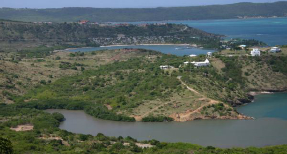
There is an alternative way down from the Shirley Heights road towards Indian Creek. Note that the clearly mapped road ( on some maps) starting off at Shirley Heights visitor center and going towards the medical school grounds is fenced off and cannot be used.
Going up along the Shirley Heights road, ride past the visitor center. The road levels off, then climbs some more before slightly dipping down. As you start climbing again, you will see an overgrown track off to the left, next to some ruined walls.
Take this track, that goes down steeply- watch the ruts. Depending on the season, it can become very faint. At the bottom of the hill you will come to a crossroad: here, a right turn will bring you to a peaceful and secluded spot on the western shore of Indian Creek, and will make you wonder why no more yachts chose to moor here. The road disappears by a farmers shack. Turn around, and you will soon be riding across the mudflats at the head of Indian Creek. There are apparently remains of an Arrawack village here... though I have never spotted anything!
The track starts again on the other side of the mudflats, and brings you out on a major dirt road.
On this road, a right turn will bring you to the little peninsula between Indian Creek and Mamora Bay (St James resort), tipped by the Clapton mansion. A left turn will bring you to the Medical School grounds gate, from which you can follow the asphalt back on to the main Willoughby/ Cobbs Cross road.