The main road to Shirley Heights
Level: Easy
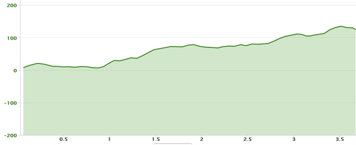
Distance: 7.4 km
Elevation Gain: 140 m
Duration: 30 mn cycling/ 1 hr walking

This is a medium steep ride or walk up from Falmouth Harbour or Nelson Dockyard, on a good asphalted road. It is a great morning or evening outing, short and not too steep. The down hill bit back home is fun if you are cycling. Unfortunately, the return trip takes the same route as on the way up.
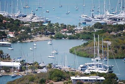
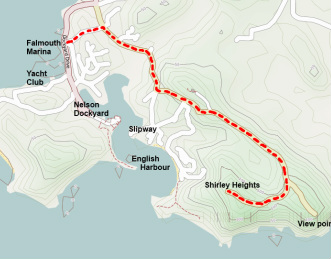
To reach the Shirley Height road, take the first inland turn past Falmouth Harbour Marina gate, with your back to Nelson dockyard. It is a steep little road starting next to the hostel and 'On Deck' sea school offices, with a little church at the top of the hill. Turn right again at the next junction and it is straight ahead. Just keep climbing.
There are a couple of crossroads leading downhill to the right as you climb, the first to the slipway and the dockyard, the second to Galleon Beach. Keep going up to the next junction, where you take a right (left leads to the visitor center). The last junction is clearly marked, one branch going to the Lookout and the other to Shirley Heights proper.
This is a hugely popular walk/cycle for locals and visitors alike on a well maintain asphalted road, with a great view from Shirley Heights itself.
|

|